


SALUDA TWP, Jefferson County, Indiana
About
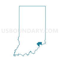
Outline

Summary
| Unique Area Identifier | 577996 |
| Name | SALUDA TWP |
| County | Jefferson County |
| State | Indiana |
| Area (square miles) | 37.69 |
| Land Area (square miles) | 37.35 |
| Water Area (square miles) | 0.34 |
| % of Land Area | 99.11 |
| % of Water Area | 0.89 |
| Latitude of the Internal Point | 38.62792400 |
| Longtitude of the Internal Point | -85.50278470 |
Maps


Graphs
Select a template below for downloading or customizing gragh for SALUDA TWP, Jefferson County, Indiana


Neighbors
Neighoring Voting District (by Name) Neighboring Voting District on the Map
- BETHLEHEM, Clark County, IN
- HANOVER TWP 2, Jefferson County, IN
- LEXINGTON 01, Scott County, IN
- REPUBLICAN TWP, Jefferson County, IN
- WASHINGTON 01, Clark County, IN
Top 10 Neighboring County Subdivision (by Population) Neighboring County Subdivision on the Map
- Bedford CCD, Trimble County, KY (5,408)
- Hanover township, Jefferson County, IN (5,366)
- Lexington township, Scott County, IN (3,551)
- Milton CCD, Trimble County, KY (3,401)
- Washington township, Clark County, IN (1,702)
- Republican township, Jefferson County, IN (1,599)
- Saluda township, Jefferson County, IN (1,370)
- Bethlehem township, Clark County, IN (309)
Top 10 Neighboring Unified School District (by Population) Neighboring Unified School District on the Map
- Greater Clark County Schools, IN (74,124)
- Scott County School District 2, IN (17,548)
- Southwestern Jefferson County Consolidated Schools, IN (9,431)
- Trimble County School District, KY (8,809)
Top 10 Neighboring State Legislative District Lower Chamber (by Population) Neighboring State Legislative District Lower Chamber on the Map
- State House District 66, IN (64,746)
- State House District 69, IN (62,245)
- State House District 47, KY (46,003)
Top 10 Neighboring State Legislative District Upper Chamber (by Population) Neighboring State Legislative District Upper Chamber on the Map
Top 10 Neighboring 111th Congressional District (by Population) Neighboring 111th Congressional District on the Map
Top 10 Neighboring Census Tract (by Population) Neighboring Census Tract on the Map
- Census Tract 9671, Scott County, IN (5,739)
- Census Tract 1002, Trimble County, KY (5,408)
- Census Tract 510, Clark County, IN (4,738)
- Census Tract 9662, Jefferson County, IN (4,719)
- Census Tract 9663, Jefferson County, IN (3,884)
- Census Tract 1001, Trimble County, KY (3,401)
Top 10 Neighboring 5-Digit ZIP Code Tabulation Area (by Population) Neighboring 5-Digit ZIP Code Tabulation Area on the Map
- 47243, IN (5,951)
- 40006, KY (5,084)
- 47138, IN (4,373)
- 40045, KY (3,451)
- 47147, IN (945)
- 47162, IN (829)